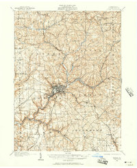
1909 Map of Butler
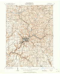
USGS Topo · Published 1957About this map
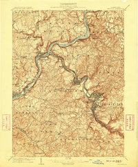
Butler serves as the industrial and logistical hub of this western Pennsylvania landscape at the opening of the twentieth century, anchored by a dense grid of streets and surrounded by satellite communities like Lyndora and Bredinville. The region's development is closely tied to an intricate network of competing rail lines, including the Bessemer and Lake Erie RR and the Pittsburgh and Western RR, which trace the winding paths of Connoquenessing Creek and its tributaries. Outside the city center, the terrain is dotted with one-room schoolhouses like St Clare School and McKee School, as well as gathering places like Alameda Park. This survey reveals a transition from a rural agricultural base to an industrial economy, where small settlements like East Butler and Renfrew emerged along the river valleys and rail junctions. Notable landmarks such as Frazier Mill and various country churches highlight the scattered, localized nature of community life during this era.
Find a feature on this map
91 named features on this map. Tap any name to fly to it.
Don’t see what you’re looking for? This feature index may not catch every label — zoom into the map to look around manually.
Map Details
Editions of this 1909 Butler Map
2 editions found
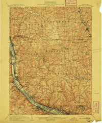
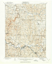
Other maps of this area

1900 · Kittanning
USGS Topo · 1:62,500

1902 · Kittanning
USGS Topo · 1:62,500

1906 · Sewickley
USGS Topo · 1:62,500

1907 · Foxburg
USGS Topo · 1:62,500

1907 · Freeport
USGS Topo · 1:62,500

1908 · Foxburg
USGS Topo · 1:62,500
1908 · Sewickley
USGS Topo · 1:62,500

1908 · New Kensington
USGS Topo · 1:62,500
1908 · Zelienople
USGS Topo · 1:62,500
1909 · Freeport
USGS Topo · 1:62,500