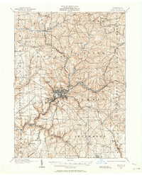
1909 Map of Butler
USGS Topo · Published 1964About this map
Butler serves as the focal point of this industrial and agricultural landscape in the early twentieth century, where the convergence of several major railroads drove local development. The Bessemer and Lake Erie, Baltimore and Ohio, and the Pittsburgh and Butler Electric lines create a dense network of transit through the valleys of Connoquenessing Creek and its tributaries. Outside the main borough, the terrain is dotted with small rural communities like Saxonburg, Oneida, and Boydstown.
Find a feature on this map
109 named features on this map. Tap any name to fly to it.
Don’t see what you’re looking for? This feature index may not catch every label — zoom into the map to look around manually.
Map Details
Editions of this 1909 Butler Map
2 editions found

Other maps of this area

1900 · Kittanning
USGS Topo · 1:62,500

1902 · Kittanning
USGS Topo · 1:62,500

1906 · Sewickley
USGS Topo · 1:62,500

1907 · Foxburg
USGS Topo · 1:62,500

1907 · Freeport
USGS Topo · 1:62,500

1908 · Foxburg
USGS Topo · 1:62,500

1908 · Sewickley
USGS Topo · 1:62,500

1908 · New Kensington
USGS Topo · 1:62,500

1908 · Zelienople
USGS Topo · 1:62,500

1909 · Freeport
USGS Topo · 1:62,500