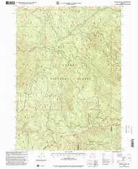
1998 Map of Butler Butte
USGS Topo · Published 2000About this map
Umpqua National Forest and Rogue River National Forest meet at the Douglas and Jackson county line, where complex terrain and water systems define the landscape. This late-twentieth-century revision highlights a region shaped by timber and outdoor recreation, notably featuring the Words Tallest Sugarpine landmark and several remote camps like Freezeout Camp and Whisky Camp. The map details the drainage patterns of Jackson Creek and its many tributaries, such as Tallow Creek and Crooked Creek, which flow through the high ridges of the Grassy Range and Bald Ridge. Geologic interest is found at Cow Horn Arch and the prominent heights of Butler Butte, while various quarries indicate local resource extraction in this wooded mountainous area.
Find a feature on this map
44 named features on this map. Tap any name to fly to it.
Don’t see what you’re looking for? This feature index may not catch every label — zoom into the map to look around manually.
Map Details
Editions of this 1998 Butler Butte Map
This is the sole edition of this map. No revisions or reprints were ever made.
Other maps of this area

1891 · Ashland
USGS Topo · 1:250,000

1893 · Ashland
USGS Topo · 1:250,000

1897 · Ashland
USGS Topo · 1:250,000

1944 · Tiller
USGS Topo · 1:62,500

1944 · Abbott Butte
USGS Topo · 1:62,500

1947 · Abbott Butte
USGS Topo · 1:62,500

1955 · Quartz Mtn
USGS Topo · 1:62,500

1955 · Red Butte
USGS Topo · 1:62,500

1955 · Medford
USGS Topo · 1:250,000

1957 · Medford
USGS Topo · 1:250,000