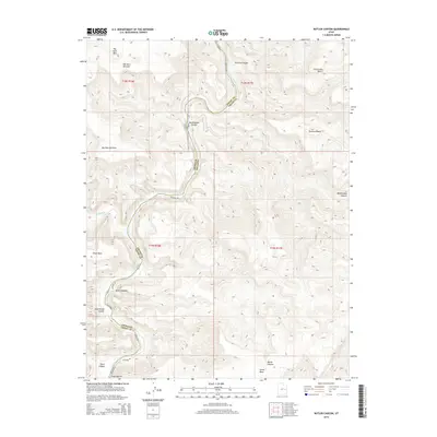
2014 Map of Butler Canyon
USGS Topo · Published 2014About this map
The Green River carves a deep, winding course through the heart of this high-desert terrain, serving as the primary boundary between Emery County and Grand County. This 2014 survey documents the meeting of the Price River and Green River at the southern end of the sheet, a critical hydrological junction in the arid landscape. The topography is defined by significant elevation changes, from the heights of Big Horn Mtn and Elliot Mesa to the drainage systems of Butler Canyon and Rattlesnake Canyon. A singular artery, Hastings Rd, provides the primary access through the region, following the natural contours of the canyons and benches. The map reveals a land characterized by its severe erosion patterns, evidenced by landforms like Poverty Bench and Suluar Mesa, which overlook the canyon floors and seasonal flows of Coal Cr.
Find a feature on this map
22 named features on this map. Tap any name to fly to it.
Don’t see what you’re looking for? This feature index may not catch every label — zoom into the map to look around manually.
Map Details
Editions of this 2014 Butler Canyon Map
This is the sole edition of this map. No revisions or reprints were ever made.
Other maps of this area

1885 · East Tavaputs
USGS Topo · 1:250,000

1886 · Price River
USGS Topo · 1:250,000

1896 · Price River
USGS Topo · 1:250,000

1954 · Range Creek
USGS Topo · 1:62,500

1956 · Price
USGS Topo · 1:250,000

1956 · Grand Junction
USGS Topo · 1:250,000

1959 · Grand Junction
USGS Topo · 1:250,000

1960 · Price
USGS Topo · 1:250,000

1960 · Grand Junction
USGS Topo · 1:250,000

1962 · Grand Junction
USGS Topo · 1:250,000