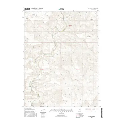
2017 Map of Butler Canyon
USGS Topo · Published 2017About this map
The Green River carves a deep, winding path through this corner of the Colorado Plateau, serving as the primary geographic driver for the landscape's orientation. Its serpentine course defines the border between Emery and Grand Counties, while its confluence with the Price River marks a significant hydrological junction in the western portion of the quadrangle. The terrain is characterized by massive, tiered formations such as Big Horn Mtn and Suluar Mesa, which rise above the river valley in a series of sharp escarpments and broad benches.
Find a feature on this map
19 named features on this map. Tap any name to fly to it.
Don’t see what you’re looking for? This feature index may not catch every label — zoom into the map to look around manually.
Map Details
Editions of this 2017 Butler Canyon Map
This is the sole edition of this map. No revisions or reprints were ever made.
Other maps of this area

1885 · East Tavaputs
USGS Topo · 1:250,000

1886 · Price River
USGS Topo · 1:250,000

1896 · Price River
USGS Topo · 1:250,000

1954 · Range Creek
USGS Topo · 1:62,500

1956 · Price
USGS Topo · 1:250,000

1956 · Grand Junction
USGS Topo · 1:250,000

1959 · Grand Junction
USGS Topo · 1:250,000

1960 · Price
USGS Topo · 1:250,000

1960 · Grand Junction
USGS Topo · 1:250,000

1962 · Grand Junction
USGS Topo · 1:250,000