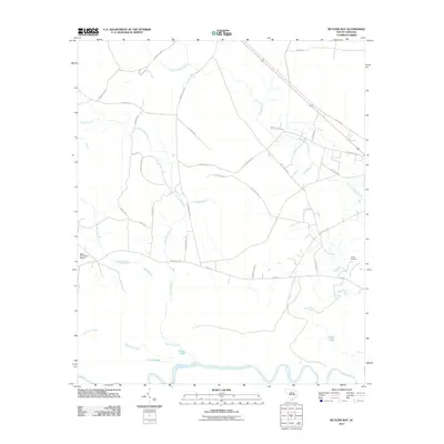
2011 Map of Butlers Bay
USGS Topo · Published 2011About this map
The Santee River snakes across the southern border of this landscape, defining a complex network of wetlands and oxbow formations including Broad Lake, Franks Lake, and Little Lake. Further north, the terrain transitions into a web of agricultural roads and rural crossings, most notably the intersection at Baggette Xrds. The map documents a low-lying environment dominated by drainage systems like Mount Hope Swamp and numerous seasonal watercourses such as Doctor Branch and Highland Creek.
Find a feature on this map
36 named features on this map. Tap any name to fly to it.
Don’t see what you’re looking for? This feature index may not catch every label — zoom into the map to look around manually.
Map Details
Editions of this 2011 Butlers Bay Map
This is the sole edition of this map. No revisions or reprints were ever made.
Other maps of this area

1920 · Chicora
USGS Topo · 1:48,000

1920 · Manning
USGS Topo · 1:48,000

1921 · Chicora
USGS Topo · 1:62,500

1921 · Manning
USGS Topo · 1:62,500

1943 · Chicora
USGS Topo · 1:62,500

1943 · Bonneau
USGS Topo · 1:62,500

1944 · Manning
USGS Topo · 1:62,500

1946 · Kingstree
USGS Topo · 1:62,500

1949 · Georgetown
USGS Topo · 1:250,000

1954 · Augusta
USGS Topo · 1:250,000