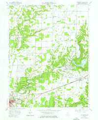
1957 Map of Butlerville
USGS Topo · Published 1976About this map
Selmier State Forest and the winding Vernon Fork Muscatatuck River dominate this mid-century landscape of Jennings County. The map documents a transition in infrastructure, where the Baltimore and Ohio and Pennsylvania railroad lines cross paths with growing local hubs like Butlerville and Brewersville. A significant institutional footprint is visible at the Muscatatuck State School, which features its own dedicated waterworks and sewage disposal systems.
Find a feature on this map
41 named features on this map. Tap any name to fly to it.
Don’t see what you’re looking for? This feature index may not catch every label — zoom into the map to look around manually.
Map Details
Editions of this 1957 Butlerville Map
3 editions found
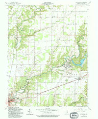
Other maps of this area

1942 · Columbus
USGS Topo · 1:125,000

1953 · Cincinnati
USGS Topo · 1:250,000

1956 · Louisville
USGS Topo · 1:250,000

1957 · Cincinnati
USGS Topo · 1:250,000

1957 · Butlerville
USGS Topo · 1:24,000

1957 · North Vernon
USGS Topo · 1:24,000

1958 · Millhousen
USGS Topo · 1:24,000

1958 · Westport
USGS Topo · 1:24,000

1958 · Grammer
USGS Topo · 1:24,000

1959 · Holton
USGS Topo · 1:24,000