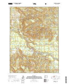
2020 Map of Butte Falls
USGS Topo · Published 2020About this map
Butte Falls serves as the central hub of this Jackson County survey, situated at the confluence of several logging roads and the South Fork Big Butte Creek. The topography is defined by significant elevations such as Santiam Peak and Fredenburg Butte, while the Rogue River National Forest encompasses the southeastern reaches. A notable engineering feature, the Medford Aqueduct, traverses the landscape west of the town site, following the contours of the drainage basin. Local history and genealogy interest is anchored by the Butte Falls Cem and various family-named landmarks like Beekman Ridge and Beekman Flat. The area’s hydrology is remarkably dense, featuring Summit Lake, Jerry Gotto Spring, and numerous tributaries like Lick Cr and Ginger Cr that feed into the larger creek systems.
Find a feature on this map
83 named features on this map. Tap any name to fly to it.
Don’t see what you’re looking for? This feature index may not catch every label — zoom into the map to look around manually.
Map Details
Editions of this 2020 Butte Falls Map
This is the sole edition of this map. No revisions or reprints were ever made.
Other maps of this area

1891 · Ashland
USGS Topo · 1:250,000

1893 · Ashland
USGS Topo · 1:250,000

1897 · Ashland
USGS Topo · 1:250,000

1938 · Medford
USGS Topo · 1:125,000

1954 · Butte Falls
USGS Topo · 1:62,500

1954 · Lakecreek
USGS Topo · 1:62,500

1955 · Rustler Peak
USGS Topo · 1:62,500

1955 · Mt. Mc Loughlin
USGS Topo · 1:62,500

1955 · Medford
USGS Topo · 1:250,000

1957 · Medford
USGS Topo · 1:250,000