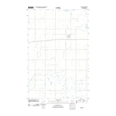
2011 Map of Butte
USGS Topo · Published 2011About this map
Butte serves as the central hub of this North Dakota landscape, situated along the intersection of County Hwy 33 and a grid of local avenues and streets. The town's layout is defined by thoroughfares such as N Main St and Coteau St, which anchor the small residential and commercial core. North of the town, Cottonwood Lake dominates the upper terrain, marking a distinct hydrologic feature in a region characterized by numerous small potholes and wetlands. The surrounding countryside is meticulously organized by the Public Land Survey System, with roads like 30th St N and 5th Ave NW tracing the section lines. This 2011 survey by the U.S. Geological Survey illustrates the enduring rural structure of McLean County, where the transition between the small-town grid and the expansive agricultural sections remains sharp and well-defined.
Find a feature on this map
21 named features on this map. Tap any name to fly to it.
Don’t see what you’re looking for? This feature index may not catch every label — zoom into the map to look around manually.
Map Details
Editions of this 2011 Butte Map
This is the sole edition of this map. No revisions or reprints were ever made.
Other maps of this area

1929 · Kongsberg
USGS Topo · 1:62,500

1929 · Balfour
USGS Topo · 1:62,500

1945 · Pelican Lake
USGS Topo · 1:62,500

1947 · Pelican Lake
USGS Topo · 1:62,500

1947 · Turtle Lake
USGS Topo · 1:62,500

1954 · McClusky
USGS Topo · 1:250,000

1958 · McClusky
USGS Topo · 1:250,000

1958 · Butte
USGS Topo · 1:24,000
1958 · Kongsberg NE
USGS Topo · 1:24,000
1958 · Balfour NW
USGS Topo · 1:24,000