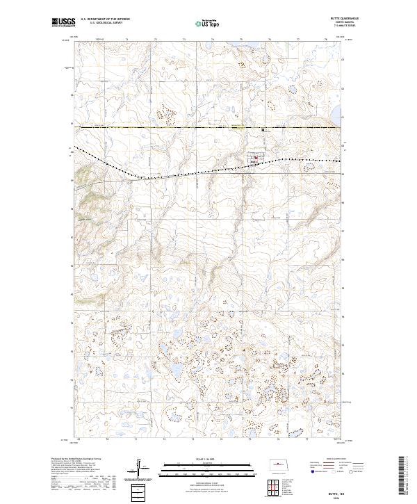
2024 Map of Butte
USGS Topo · Published 2024About this map
Dogden Butte rises as a prominent landmark in this corner of North Dakota, presiding over a landscape defined by its wetlands and small-town layout. The settlement of Butte sits near the county line, featuring a traditional grid anchored by 3rd Ave and 4th Ave. This area is a critical corridor for migratory birds, with large sections of land dedicated to conservation, including the Cottonwood Lake National Wildlife Refuge and the sprawling McLean County Waterfowl Production Area. For genealogists and local historians, the Butte Cem north of town provides a specific point of interest. The map detail reflects the region's agricultural and conservation balance, showing the precise township and range boundaries such as t150n r78w that have organized this prairie since the initial land surveys.
Find a feature on this map
35 named features on this map. Tap any name to fly to it.
Don’t see what you’re looking for? This feature index may not catch every label — zoom into the map to look around manually.
Map Details
Editions of this 2024 Butte Map
This is the sole edition of this map. No revisions or reprints were ever made.
Other maps of this area

1929 · Kongsberg
USGS Topo · 1:62,500

1929 · Balfour
USGS Topo · 1:62,500

1945 · Pelican Lake
USGS Topo · 1:62,500

1947 · Pelican Lake
USGS Topo · 1:62,500

1947 · Turtle Lake
USGS Topo · 1:62,500

1954 · McClusky
USGS Topo · 1:250,000

1958 · McClusky
USGS Topo · 1:250,000

1958 · Butte
USGS Topo · 1:24,000
1958 · Kongsberg NE
USGS Topo · 1:24,000
1958 · Balfour NW
USGS Topo · 1:24,000