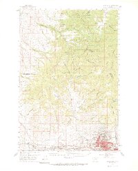
1959 Map of Butte North
USGS Topo · Published 1969About this map
The massive mining infrastructure and urban footprint of Butte dominate the southern portion of this landscape, showcasing the intense industrial activity that shaped Silver Bow County during the late 1950s. The urban sprawl extends into neighboring Walkerville, Centerville, and Meaderville, where the industrial scale is evidenced by the massive Berkeley Pit and the nearby Montana Sch of Mines. Rail lines including the Northern Pacific and the Chicago Milwaukee St Paul and Pacific converge at Nissler, illustrating the vital transportation network required to move ore from mines like the Butte Pacific Mine and Butte and Zenith Mine.
Find a feature on this map
62 named features on this map. Tap any name to fly to it.
Don’t see what you’re looking for? This feature index may not catch every label — zoom into the map to look around manually.
Map Details
Editions of this 1959 Butte North Map
3 editions found

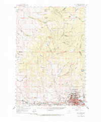
Other maps of this area

1889 · Helena
USGS Topo · 1:250,000

1893 · Helena
USGS Topo · 1:250,000

1893 · Dillon
USGS Topo · 1:250,000

1899 · Boulder
USGS Topo · 1:125,000

1899 · Helena
USGS Topo · 1:250,000

1903 · Helena
USGS Topo · 1:250,000

1947 · Butte
USGS Topo · 1:250,000

1954 · Elk Park
USGS Topo · 1:62,500

1954 · Basin
USGS Topo · 1:62,500

1955 · Dillon
USGS Topo · 1:250,000