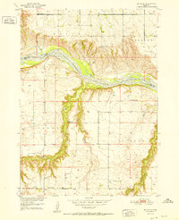
1952 Map of Butte SE
USGS Topo · Published 1952About this map
The Niobrara River winds through the northern portion of this Nebraska landscape, marking the boundary between Boyd and Holt Counties. This early 1950s survey captures a transition in rural education, documenting several local schools including School No 12, School No 53, and School No 68. Most notable for local historians is the site of School No 193 (Abandoned) located near the banks of Brush Creek.
Find a feature on this map
16 named features on this map. Tap any name to fly to it.
Don’t see what you’re looking for? This feature index may not catch every label — zoom into the map to look around manually.
Map Details
Editions of this 1952 Butte SE Map
2 editions found
Other maps of this area

1951 · Butte NW
USGS Topo · 1:24,000

1951 · Butte SW
USGS Topo · 1:24,000

1952 · Spencer South
USGS Topo · 1:24,000

1952 · Butte SE
USGS Topo · 1:24,000

1954 · Meek
USGS Topo · 1:24,000

1954 · Atkinson NW
USGS Topo · 1:24,000

1954 · Atkinson NE
USGS Topo · 1:24,000

1955 · O'Neill
USGS Topo · 1:250,000

1959 · O'Neill
USGS Topo · 1:250,000

1964 · Butte
USGS Topo · 1:24,000