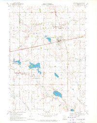
1970 Map of Butterfield
USGS Topo · Published 1972About this map
The Butterfield community is the focal point of this 1970 survey, situated at the crossing of the Chicago and North Western railroad and local transport routes. The landscape is defined by its glacial hydrology, with Sulem Lake, Butterfield Lake, and School Lake dotting the terrain, while the South Fork Watonwan River and Butterfield Creek provide natural drainage alongside the engineered Judicial Ditch No 1.
Find a feature on this map
21 named features on this map. Tap any name to fly to it.
Don’t see what you’re looking for? This feature index may not catch every label — zoom into the map to look around manually.
Map Details
Editions of this 1970 Butterfield Map
This is the sole edition of this map. No revisions or reprints were ever made.
Other maps of this area

1953 · New Ulm
USGS Topo · 1:250,000

1954 · Fairmont
USGS Topo · 1:250,000

1957 · New Ulm
USGS Topo · 1:250,000

1958 · New Ulm
USGS Topo · 1:250,000

1958 · Fairmont
USGS Topo · 1:250,000

1967 · New Ulm
USGS Topo · 1:250,000

1967 · Godahl
USGS Topo · 1:24,000

1967 · Darfur
USGS Topo · 1:24,000
1967 · Comfrey
USGS Topo · 1:24,000
1970 · St James West
USGS Topo · 1:24,000