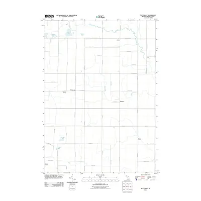
2011 Map of Butternut
USGS Topo · Published 2011About this map
Butternut and Vickeryville anchor this agricultural landscape in Montcalm County, where a grid of rural roads connects scattered homesteads and historic burying grounds. The terrain is defined by a dense network of glacial lakes and winding waterways, including Fish Creek and Butternut Creek. Genealogists will find significant value in the distribution of family-named landmarks and local resting places such as Crystal Cemetery, Burke Cemetery, and Vickeryville Cemetery.
Find a feature on this map
48 named features on this map. Tap any name to fly to it.
Don’t see what you’re looking for? This feature index may not catch every label — zoom into the map to look around manually.
Map Details
Editions of this 2011 Butternut Map
This is the sole edition of this map. No revisions or reprints were ever made.
Other maps of this area

1954 · Midland
USGS Topo · 1:250,000

1958 · Midland
USGS Topo · 1:250,000

1959 · Midland
USGS Topo · 1:250,000

1964 · Stanton
USGS Topo · 1:24,000

1965 · Sumner
USGS Topo · 1:24,000

1965 · Crystal
USGS Topo · 1:24,000

1966 · Midland
USGS Topo · 1:250,000
1967 · Palo
USGS Topo · 1:24,000
1967 · Hubbardston
USGS Topo · 1:24,000
1967 · Carson City
USGS Topo · 1:24,000