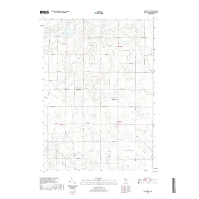
2019 Map of Butternut
USGS Topo · Published 2019About this map
Butternut and Vickeryville anchor this agricultural landscape in southeastern Montcalm County, where the terrain is defined by glacial kettle lakes and the winding course of Fish Cr. The map reveals a high density of small water bodies like Cedar Lake, Mud Lake, and Muskrat Lake in the north, while the southern reaches are drained by Bacon Cr and Butternut Cr. For those researching local families, the survey provides precise locations for the Bloomer Cem, Vickeryville Cem, Crystal Cem, and Burke Cem, which serve as vital landmarks for genealogists tracing ancestors in Crystal and Bloomer townships. The rectilinear road grid, including routes like Senator Rd and S Crystal Rd, highlights the established section-line development typical of Michigan's farming heartland during this modern era.
Find a feature on this map
59 named features on this map. Tap any name to fly to it.
Don’t see what you’re looking for? This feature index may not catch every label — zoom into the map to look around manually.
Map Details
Editions of this 2019 Butternut Map
This is the sole edition of this map. No revisions or reprints were ever made.
Other maps of this area

1954 · Midland
USGS Topo · 1:250,000

1958 · Midland
USGS Topo · 1:250,000

1959 · Midland
USGS Topo · 1:250,000

1964 · Stanton
USGS Topo · 1:24,000

1965 · Sumner
USGS Topo · 1:24,000

1965 · Crystal
USGS Topo · 1:24,000

1966 · Midland
USGS Topo · 1:250,000
1967 · Palo
USGS Topo · 1:24,000
1967 · Hubbardston
USGS Topo · 1:24,000
1967 · Carson City
USGS Topo · 1:24,000