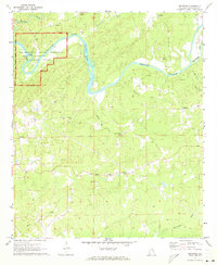
1971 Map of Buttston
USGS Topo · Published 1973About this map
Horseshoe Bend National Military Park occupies a significant horseshoe-shaped loop of the Tallapoosa River, marking the site of a pivotal conflict. This 1971 study documents the preserved landscape including the Battleground Monument, Millers Bridge, and the river's edge at Griffin Shoals. The surrounding Tallapoosa County countryside is dotted with small rural communities and local landmarks that provide valuable context for genealogists. Settlements like Buttston, Easton, and Sessions are connected by a network of creeks, including Emuckfaw Creek and Eagle Creek. Notable community centers such as Bethlehem Ch, Poplar Springs Ch, and Lebanon Ch appear alongside their respective cemeteries, anchoring the area's social and family history. Downstream from the Hamlet Mill Bridge, the terrain is defined by numerous gravel pits and the winding courses of Soapstone Creek and Chatasofka Creek.
Find a feature on this map
33 named features on this map. Tap any name to fly to it.
Don’t see what you’re looking for? This feature index may not catch every label — zoom into the map to look around manually.
Map Details
Editions of this 1971 Buttston Map
2 editions found
Other maps of this area

1891 · Ashland
USGS Topo · 1:125,000

1906 · Dadeville
USGS Topo · 1:125,000

1953 · Atlanta
USGS Topo · 1:250,000

1955 · Phenix City
USGS Topo · 1:250,000

1957 · Phenix City
USGS Topo · 1:250,000

1957 · Atlanta
USGS Topo · 1:250,000

1958 · Phenix City
USGS Topo · 1:250,000

1958 · Atlanta
USGS Topo · 1:250,000

1969 · New Site
USGS Topo · 1:24,000
1969 · Daviston
USGS Topo · 1:24,000