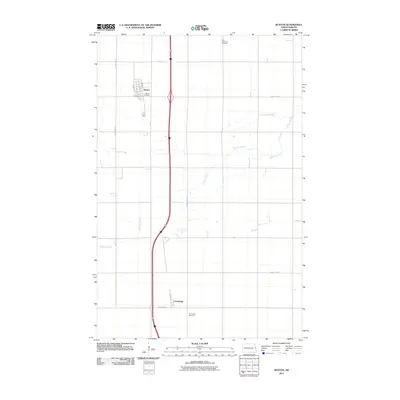
2011 Map of Buxton
USGS Topo · Published 2011About this map
Buxton and the smaller settlement of Cummings are the primary centers of activity in this section of Traill County, positioned within the fertile Red River Valley landscape. The area is defined by its grid-based agricultural layout, where County Hwy-81 and a network of arterial roads like County Hwy-21 and County Hwy-7 connect isolated farmsteads and rural landmarks. The drainage of Buffalo Coulee meanders across the plain, providing the only significant break in the otherwise flat, patterned terrain.
Find a feature on this map
18 named features on this map. Tap any name to fly to it.
Don’t see what you’re looking for? This feature index may not catch every label — zoom into the map to look around manually.
Map Details
Editions of this 2011 Buxton Map
This is the sole edition of this map. No revisions or reprints were ever made.
Other maps of this area

1918 · Kelso
USGS Topo · 1:62,500

1918 · Hendrum
USGS Topo · 1:62,500

1919 · Eldred
USGS Topo · 1:62,500

1943 · Kelso
USGS Topo · 1:62,500

1952 · Grand Forks
USGS Topo · 1:250,000

1956 · Grand Forks
USGS Topo · 1:250,000

1963 · Hillsboro
USGS Topo · 1:24,000

1964 · Climax NW
USGS Topo · 1:24,000

1964 · Climax SW
USGS Topo · 1:24,000
1964 · Caledonia
USGS Topo · 1:24,000