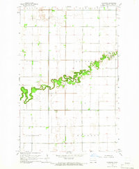
1964 Map of Caledonia
USGS Topo · Published 1966About this map
The Goose River carves a winding path across this eastern North Dakota landscape, its lush, vegetated banks contrasting sharply with the structured agricultural grid of Traill County. In the mid-1960s, the small settlement of Caledonia sits near the river's eastern bend, accompanied by a local Cem. The surrounding area is divided into several civil townships, including Eldorado, Caledonia, Hillsboro, and Herberg. This topographic record provides a clear view of the section lines and rural road networks that defined the region's movement and land use during this era. The concentration of structures and the presence of Herberg in the southern reaches reflect a quiet agricultural economy centered on these established rural centers.
Find a feature on this map
8 named features on this map. Tap any name to fly to it.
Don’t see what you’re looking for? This feature index may not catch every label — zoom into the map to look around manually.
Map Details
Editions of this 1964 Caledonia Map
This is the sole edition of this map. No revisions or reprints were ever made.
Other maps of this area

1918 · Kelso
USGS Topo · 1:62,500

1918 · Hendrum
USGS Topo · 1:62,500

1919 · Eldred
USGS Topo · 1:62,500

1943 · Kelso
USGS Topo · 1:62,500

1952 · Grand Forks
USGS Topo · 1:250,000

1956 · Grand Forks
USGS Topo · 1:250,000

1963 · Shelly
USGS Topo · 1:24,000

1963 · Halstad
USGS Topo · 1:24,000

1963 · Hillsboro
USGS Topo · 1:24,000

1963 · Kelso
USGS Topo · 1:24,000