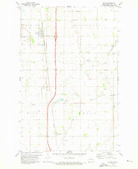
1971 Map of Buxton
USGS Topo · Published 1973About this map
The agrarian landscape of Buxton and Cummings is defined by the rigid grid of the Red River Valley, where the Burlington Northern railroad runs parallel to the modern interstate corridor. This 1971 survey reveals a community deeply rooted in its local geography, with a significant number of rural burial sites serving as markers of early settlement history. These include East Immanuel Cem, West Immanuel Cem, Reeves Cem, and the Cummings Cem. The drainage of the flat prairie is facilitated by the winding Buffalo Coulee, which cuts across the townships of Buxton, Stavanger, Wold, and Ervin. The map also captures the functional infrastructure of the era, from the Radio Tower and numerous Gravel Pits to the Sewage Disposal Ponds near the northern town site.
Find a feature on this map
17 named features on this map. Tap any name to fly to it.
Don’t see what you’re looking for? This feature index may not catch every label — zoom into the map to look around manually.
Map Details
Editions of this 1971 Buxton Map
This is the sole edition of this map. No revisions or reprints were ever made.
Other maps of this area

1918 · Kelso
USGS Topo · 1:62,500

1918 · Hendrum
USGS Topo · 1:62,500

1919 · Eldred
USGS Topo · 1:62,500

1943 · Kelso
USGS Topo · 1:62,500

1952 · Grand Forks
USGS Topo · 1:250,000

1956 · Grand Forks
USGS Topo · 1:250,000

1963 · Hillsboro
USGS Topo · 1:24,000

1964 · Climax NW
USGS Topo · 1:24,000

1964 · Climax SW
USGS Topo · 1:24,000
1964 · Caledonia
USGS Topo · 1:24,000