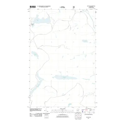
2011 Map of Buyck
USGS Topo · Published 2011About this map
Buyck serves as the primary settlement hub in this northern Minnesota landscape, situated where the Vermilion River snakes through the northeastern corner of the sheet. The area is defined by its glacial hydrology, with a dense network of water bodies including the centrally located Winchester Lake and the southern Section Thirty Lake. A notable point of specialized transport is the Kjostad Lake Seaplane Base on the western shore of Kjostad Lake, illustrating the continued importance of aerial access in remote lake country. The road network reflects a history of resource extraction and local transit, with routes like Orr Buyck Rd and Holm Logging Rd providing the primary arteries through the timbered terrain. Smaller paths such as Shuster Rd and Karth Rd branch toward individual properties and smaller water features like Olive Lake and Carlson Lake.
Find a feature on this map
24 named features on this map. Tap any name to fly to it.
Don’t see what you’re looking for? This feature index may not catch every label — zoom into the map to look around manually.
Map Details
Editions of this 2011 Buyck Map
This is the sole edition of this map. No revisions or reprints were ever made.
Other maps of this area

1954 · Hibbing
USGS Topo · 1:250,000

1954 · International Falls
USGS Topo · 1:250,000

1956 · Vermilion Dam
USGS Topo · 1:24,000

1957 · Hibbing
USGS Topo · 1:250,000

1957 · International Falls
USGS Topo · 1:250,000

1958 · International Falls
USGS Topo · 1:250,000

1958 · Hibbing
USGS Topo · 1:250,000

1963 · Echo Lake
USGS Topo · 1:24,000

1963 · Picket Lake
USGS Topo · 1:24,000

1964 · Hibbing
USGS Topo · 1:250,000