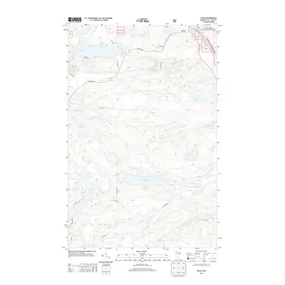
2013 Map of Buyck
USGS Topo · Published 2013About this map
The Superior National Forest dominates this landscape in northeast Minnesota, where the small settlement of Buyck sits along the Vermilion River. This 2013 survey illustrates a region defined by its complex hydrography and forestry infrastructure, with a dense network of timber-access routes like Holm Logging Rd and Orr Buyck Rd threading through the woods. Large bodies of water including Kjostad Lake, Winchester Lake, and Elbow Lake are central features of the terrain, while smaller basins like Section Thirty Lake and Olive Lake punctuate the surrounding forests. The map serves as a detailed record of the road network and water systems that sustain the local community and the surrounding federal forest lands during the early 21st century.
Find a feature on this map
29 named features on this map. Tap any name to fly to it.
Don’t see what you’re looking for? This feature index may not catch every label — zoom into the map to look around manually.
Map Details
Editions of this 2013 Buyck Map
This is the sole edition of this map. No revisions or reprints were ever made.
Other maps of this area

1954 · Hibbing
USGS Topo · 1:250,000

1954 · International Falls
USGS Topo · 1:250,000

1956 · Vermilion Dam
USGS Topo · 1:24,000

1957 · Hibbing
USGS Topo · 1:250,000

1957 · International Falls
USGS Topo · 1:250,000

1958 · International Falls
USGS Topo · 1:250,000

1958 · Hibbing
USGS Topo · 1:250,000

1963 · Echo Lake
USGS Topo · 1:24,000

1963 · Picket Lake
USGS Topo · 1:24,000

1964 · Hibbing
USGS Topo · 1:250,000