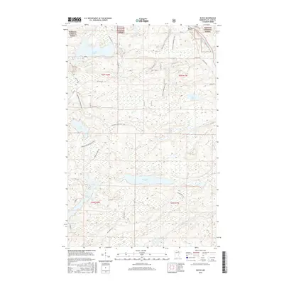
2016 Map of Buyck
USGS Topo · Published 2016About this map
The settlement of Buyck sits at the northern edge of this landscape, positioned where the Vermilion River winds through the dense woodlands of the Superior National Forest. This region is defined by an intricate network of waterways and glacial basins, including the expansive Winchester Lake and the smaller Kjostad Lake. The terrain is marked by a legacy of timber management and modern recreation, evidenced by the numerous logging and forest roads like Holm Logging Rd and Elbow Lake Forest Rd that provide access to the interior.
Find a feature on this map
34 named features on this map. Tap any name to fly to it.
Don’t see what you’re looking for? This feature index may not catch every label — zoom into the map to look around manually.
Map Details
Editions of this 2016 Buyck Map
This is the sole edition of this map. No revisions or reprints were ever made.
Other maps of this area

1954 · Hibbing
USGS Topo · 1:250,000

1954 · International Falls
USGS Topo · 1:250,000

1956 · Vermilion Dam
USGS Topo · 1:24,000

1957 · Hibbing
USGS Topo · 1:250,000

1957 · International Falls
USGS Topo · 1:250,000

1958 · International Falls
USGS Topo · 1:250,000

1958 · Hibbing
USGS Topo · 1:250,000

1963 · Echo Lake
USGS Topo · 1:24,000

1963 · Picket Lake
USGS Topo · 1:24,000

1964 · Hibbing
USGS Topo · 1:250,000