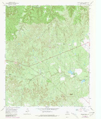
1967 Map of Buzzard Peak
USGS Topo · Published 1981About this map
Ross Ranch and Moorhouse Ranch anchor this landscape of north-central Texas, where the terrain is defined by the winding course of the South Wichita River and the deeply incised Getaway Canyon. This 1967 survey, later photorevised in 1981, illustrates a specialized ranching and extractive economy. The presence of numerous Drill Holes, a significant Oil Field, and multiple Landing Strips points to the industrial activity that shared this land with cattle operations. Water management is a primary theme, evident in the Upper Blakey Windmill and Lower Blakey Windmill, as well as the Snake Den Tank and man-made reservoirs along Little Croton Creek. From the heights of Buzzard Peak down to the gravel pits and pipelines, the map documents the infrastructure required to sustain life and industry in King County.
Find a feature on this map
23 named features on this map. Tap any name to fly to it.
Don’t see what you’re looking for? This feature index may not catch every label — zoom into the map to look around manually.
Map Details
Editions of this 1967 Buzzard Peak Map
2 editions found
Other maps of this area

1954 · Lubbock
USGS Topo · 1:250,000

1954 · Wichita Falls
USGS Topo · 1:250,000

1958 · Wichita Falls
USGS Topo · 1:250,000

1966 · Ox Yoke Creek
USGS Topo · 1:24,000

1966 · J Y Ranch
USGS Topo · 1:24,000

1966 · Maverick Flat
USGS Topo · 1:24,000

1967 · Cedar Mountain
USGS Topo · 1:24,000

1967 · Dark Canyon
USGS Topo · 1:24,000

1967 · Knox City NW
USGS Topo · 1:24,000

1967 · Kiowa Peak NW
USGS Topo · 1:24,000