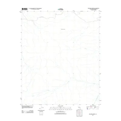
2012 Map of Buzzard Spring
USGS Topo · Published 2012About this map
The Eagle Mountains dominate this high-desert landscape in Riverside County, providing a stark topographical backdrop to a region defined by its water resources and industrial access. Buzzard Spring appears as a critical water point in this arid terrain, while the massive infrastructure of the Colorado River Aqueduct cuts across the southeastern corner, illustrating the 20th-century engineering efforts to transport water across the California desert. Transportation through this remote section of the county is primarily facilitated by the Black Eagle Mine Rd in the north, which hints at the area's mining history. The drainage patterns of the Big Wash weave through the valley floors, marking the seasonal paths of desert runoff through the mountain passes.
Find a feature on this map
5 named features on this map. Tap any name to fly to it.
Don’t see what you’re looking for? This feature index may not catch every label — zoom into the map to look around manually.
Map Details
Editions of this 2012 Buzzard Spring Map
This is the sole edition of this map. No revisions or reprints were ever made.
Other maps of this area

1940 · Canyon Spring
USGS Topo · 1:62,500

1943 · Canyon Spring
USGS Topo · 1:62,500

1943 · Coxcomb Mountains
USGS Topo · 1:62,500

1944 · Eagle Tank
USGS Topo · 1:62,500

1944 · Chuckwalla Mountains
USGS Topo · 1:62,500

1944 · Coxcomb Mountains
USGS Topo · 1:62,500

1954 · Salton Sea
USGS Topo · 1:250,000

1955 · Salton Sea
USGS Topo · 1:250,000

1959 · Salton Sea
USGS Topo · 1:250,000

1963 · Salton Sea
USGS Topo · 1:250,000