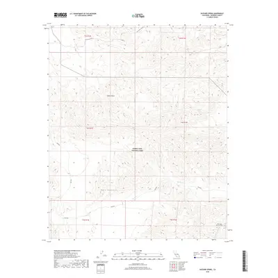
2018 Map of Buzzard Spring
USGS Topo · Published 2018About this map
Joshua Tree National Park occupies much of this arid landscape, where the Eagle Mountains and the Mojave Desert converge. A critical piece of California's water infrastructure, the Colorado River Aqueduct, enters the frame in the southeast corner, disappearing into the West Eagle Mountain Tunnel as it traverses the desert floor. This modern survey illustrates the rugged drainage patterns of the Big Wash system, which snakes through the eastern slopes of the range. Higher in the elevations, Black Eagle Mine Rd provides a historical trace of the area's prospecting past, leading toward interior canyon reaches. The namesake Buzzard Spring remains a notable landmark in a region defined by its scarcity of water and stark geologic relief.
Find a feature on this map
14 named features on this map. Tap any name to fly to it.
Don’t see what you’re looking for? This feature index may not catch every label — zoom into the map to look around manually.
Map Details
Editions of this 2018 Buzzard Spring Map
This is the sole edition of this map. No revisions or reprints were ever made.
Other maps of this area

1940 · Canyon Spring
USGS Topo · 1:62,500

1943 · Canyon Spring
USGS Topo · 1:62,500

1943 · Coxcomb Mountains
USGS Topo · 1:62,500

1944 · Eagle Tank
USGS Topo · 1:62,500

1944 · Chuckwalla Mountains
USGS Topo · 1:62,500

1944 · Coxcomb Mountains
USGS Topo · 1:62,500

1954 · Salton Sea
USGS Topo · 1:250,000

1955 · Salton Sea
USGS Topo · 1:250,000

1959 · Salton Sea
USGS Topo · 1:250,000

1963 · Salton Sea
USGS Topo · 1:250,000