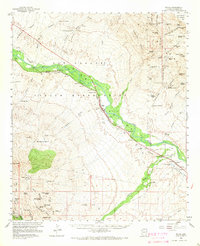
1960 Map of Bylas
USGS Topo · Published 1966About this map
The Gila Valley is the central artery of this mid-century survey, where the Gila River cuts through the high desert of the San Carlos Indian Res. Settlement follows the water and the Southern Pacific tracks, connecting the communities of Bylas, Geronimo, and Calva. These desert towns served as vital points for ranching and transport before the landscape rises toward the peaks of the south, including Mt Turnbull and the Coronado Nat For boundary.
Find a feature on this map
95 named features on this map. Tap any name to fly to it.
Don’t see what you’re looking for? This feature index may not catch every label — zoom into the map to look around manually.
Map Details
Editions of this 1960 Bylas Map
2 editions found

Other maps of this area

1938 · Klondyke
USGS Topo · 1:48,000

1943 · Klondyke
USGS Topo · 1:62,500

1944 · Jackson Mtn.
USGS Topo · 1:62,500

1946 · Jackson Mtn.
USGS Topo · 1:62,500

1954 · Silver City
USGS Topo · 1:250,000

1954 · Clifton
USGS Topo · 1:250,000

1954 · Mesa
USGS Topo · 1:250,000

1956 · Tucson
USGS Topo · 1:250,000

1957 · Mesa
USGS Topo · 1:250,000

1957 · Clifton
USGS Topo · 1:250,000