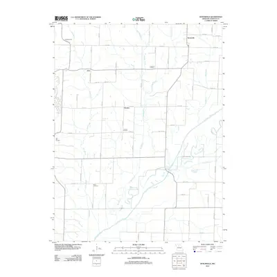
2012 Map of Bynumville
USGS Topo · Published 2012About this map
The Chariton River carves a winding path through this portion of Chariton County, defining a landscape of riparian bottoms and upland prairies. The small settlements of Bynumville, Hamden, and Echo anchor the region's rural character, connected by a network of county roads like Co RD-326 and Co RD-330. These communities represent the enduring agricultural heritage of north-central Missouri, where the land is primarily divided by drainage systems like Bee Branch and Elm Branch.
Find a feature on this map
52 named features on this map. Tap any name to fly to it.
Don’t see what you’re looking for? This feature index may not catch every label — zoom into the map to look around manually.
Map Details
Editions of this 2012 Bynumville Map
This is the sole edition of this map. No revisions or reprints were ever made.
Other maps of this area

1890 · Glasgow
USGS Topo · 1:125,000

1953 · Moberly
USGS Topo · 1:250,000

1953 · Marceline
USGS Topo · 1:24,000

1953 · Clifton Hill
USGS Topo · 1:24,000

1953 · Prairie Hill
USGS Topo · 1:24,000

1953 · Lagonda
USGS Topo · 1:24,000

1953 · Wien
USGS Topo · 1:24,000

1953 · Bynumville
USGS Topo · 1:24,000
1953 · Mike
USGS Topo · 1:24,000

1954 · Moberly
USGS Topo · 1:250,000