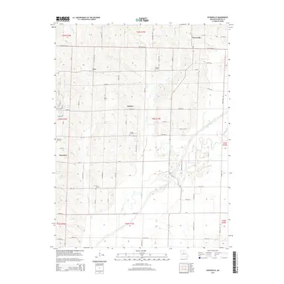
2014 Map of Bynumville
USGS Topo · Published 2014About this map
The Chariton River carves a serpentine path through the southern half of this Chariton County region, defining a landscape marked by extensive bottomlands and a network of secondary waterways. Small rural settlements like Bynumville, Hamden, Echo, and Musselfork anchor a grid of county roads that navigate the uplands between drainage basins. The area's settlement history is deeply etched in its burial grounds, including Fairview Cemetery, Fitzgerald Cemetery, Musselfork Cemetery, and Parks Cemetery, which are scattered among the farms. A complex system of creeks, such as Bee Br, W Bee Br, and E Bee Br, feeds into the main river channel, illustrating the intricate natural drainage that has influenced local agricultural patterns and road placement for generations.
Find a feature on this map
105 named features on this map. Tap any name to fly to it.
Don’t see what you’re looking for? This feature index may not catch every label — zoom into the map to look around manually.
Map Details
Editions of this 2014 Bynumville Map
This is the sole edition of this map. No revisions or reprints were ever made.
Other maps of this area

1890 · Glasgow
USGS Topo · 1:125,000

1953 · Moberly
USGS Topo · 1:250,000

1953 · Marceline
USGS Topo · 1:24,000

1953 · Clifton Hill
USGS Topo · 1:24,000

1953 · Prairie Hill
USGS Topo · 1:24,000

1953 · Lagonda
USGS Topo · 1:24,000

1953 · Wien
USGS Topo · 1:24,000

1953 · Bynumville
USGS Topo · 1:24,000
1953 · Mike
USGS Topo · 1:24,000

1954 · Moberly
USGS Topo · 1:250,000