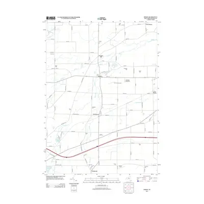
2013 Map of Byron
USGS Topo · Published 2013About this map
Byron and South Byron serve as central hubs in this Western New York agricultural landscape, where the drainage of Black Cr and Bigelow Cr dictates the local geography. The map reveals a high density of small family and community burial grounds, such as Sodom Cem and Walkers Cem, which are invaluable for genealogical research in Genesee County. To the north, prominent elevations like Pumpkin Hill and Lidke Hill rise above the surrounding fields, while the southern portion of the quadrangle shows the influence of modern infrastructure with the path of Interstate 90. Local enterprise is evident at Schafer Potato Farms, and recreational or utility sites like Godfreys Pond and Southwoods Recreational Vehicle Resort show how the land has been adapted for modern use while maintaining its rural character.
Find a feature on this map
100 named features on this map. Tap any name to fly to it.
Don’t see what you’re looking for? This feature index may not catch every label — zoom into the map to look around manually.
Map Details
Editions of this 2013 Byron Map
This is the sole edition of this map. No revisions or reprints were ever made.
Other maps of this area

1897 · Albion
USGS Topo · 1:62,500

1899 · Brockport
USGS Topo · 1:62,500

1904 · Batavia
USGS Topo · 1:62,500

1904 · Caledonia
USGS Topo · 1:62,500

1934 · Brockport
USGS Topo · 1:24,000

1935 · Churchville
USGS Topo · 1:24,000

1944 · Churchville
USGS Topo · 1:31,680

1944 · Holley
USGS Topo · 1:31,680

1944 · Byron
USGS Topo · 1:31,680

1944 · Stafford
USGS Topo · 1:31,680