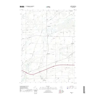
2019 Map of Byron
USGS Topo · Published 2019About this map
Byron and South Byron serve as central nodes in this Genesee County landscape, where the drainage of Black Cr and Bigelow Cr shapes the agricultural and natural layout. The northern reaches are defined by the extensive Byron Bergen Swamp, a significant wetland complex situated near North Bergen. This map is particularly dense with genealogical markers, recording numerous burial grounds such as Sodom Cem, Walker Cem, and Thwing Cem, which are scattered among prominent elevations like Pumpkin Hill and Casswell Hill. The transition from historic water-power sites, exemplified by Mill Pond, to modern aviation is evident through the presence of both the Byron Airpark and Stafford Airport. These features, along with the cluster of family-named cemeteries near Morganville, illustrate a long-settled rural community that maintains its primary crossroads and wetland boundaries.
Find a feature on this map
102 named features on this map. Tap any name to fly to it.
Don’t see what you’re looking for? This feature index may not catch every label — zoom into the map to look around manually.
Map Details
Editions of this 2019 Byron Map
This is the sole edition of this map. No revisions or reprints were ever made.
Other maps of this area

1897 · Albion
USGS Topo · 1:62,500

1899 · Brockport
USGS Topo · 1:62,500

1904 · Batavia
USGS Topo · 1:62,500

1904 · Caledonia
USGS Topo · 1:62,500

1934 · Brockport
USGS Topo · 1:24,000

1935 · Churchville
USGS Topo · 1:24,000

1944 · Churchville
USGS Topo · 1:31,680

1944 · Holley
USGS Topo · 1:31,680

1944 · Byron
USGS Topo · 1:31,680

1944 · Stafford
USGS Topo · 1:31,680