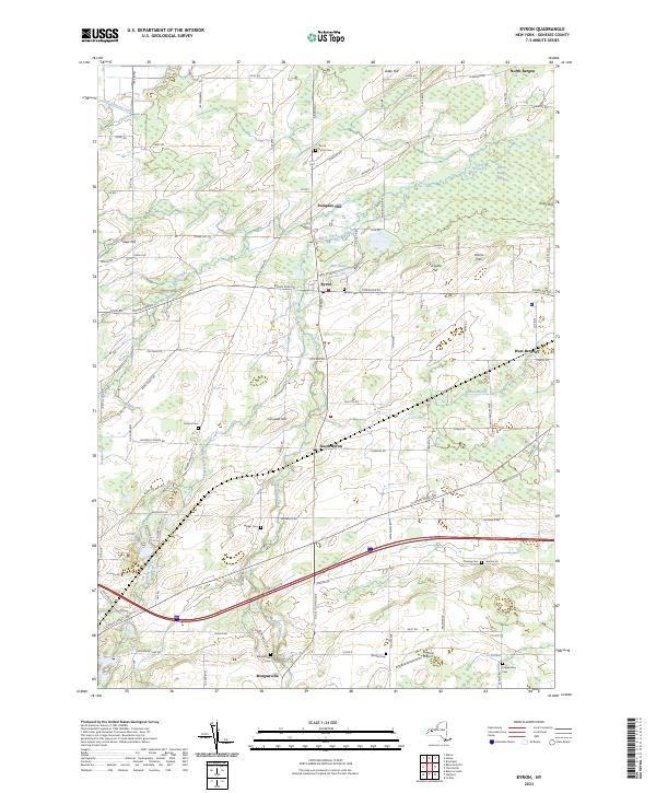
2023 Map of Byron
USGS Topo · Published 2023About this map
Byron and South Byron serve as central hubs in this Western New York landscape, where the agricultural grid is interrupted by the expansive Byron-Bergen Swamp. The topography is defined by a series of distinct rises such as Pumpkin Hill, Casswell Hill, and Forsythe Hill, which overlook the meandering paths of Black Creek and Oak Orchard Creek. For genealogists and local historians, the area is notably dense with burial grounds, including the North Byron Cem, Sodom Cem, and the Walker Cem near Griswold Rd.
Find a feature on this map
98 named features on this map. Tap any name to fly to it.
Don’t see what you’re looking for? This feature index may not catch every label — zoom into the map to look around manually.
Map Details
Editions of this 2023 Byron Map
This is the sole edition of this map. No revisions or reprints were ever made.
Other maps of this area

1897 · Albion
USGS Topo · 1:62,500

1899 · Brockport
USGS Topo · 1:62,500

1904 · Batavia
USGS Topo · 1:62,500

1904 · Caledonia
USGS Topo · 1:62,500

1934 · Brockport
USGS Topo · 1:24,000

1935 · Churchville
USGS Topo · 1:24,000

1944 · Churchville
USGS Topo · 1:31,680

1944 · Holley
USGS Topo · 1:31,680

1944 · Byron
USGS Topo · 1:31,680

1944 · Stafford
USGS Topo · 1:31,680