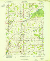
1952 Map of Byron
USGS Topo · Published 1952About this map
Byron and its surrounding agricultural landscape in Genesee County are defined by a sophisticated mid-century transportation network where the New York Central Railroad and Lehigh Valley Railroad intersect the rural grid. This 1952 edition showcases the importance of local rail junctions at settlements like South Byron and Morganville. The map captures a transition in navigation and land use, featuring a prominent Airway Beacon near West Bergen alongside well-established local landmarks such as Lidke Hill and Pumpkin Hill. To the northeast, the Bergen Swamp Wildlife Sanctuary stands out as a significant preserved natural feature, with Black Creek and Robins Brook threading through the lowlands. For the genealogist, the map is particularly useful for locating numerous smaller burial grounds, including Sodom Cem, Walkers Cem, and Randall Cem, often found at remote intersections like Buckley Road and North Bergen Road.
Find a feature on this map
48 named features on this map. Tap any name to fly to it.
Don’t see what you’re looking for? This feature index may not catch every label — zoom into the map to look around manually.
Map Details
Editions of this 1952 Byron Map
This is the sole edition of this map. No revisions or reprints were ever made.
Other maps of this area

1897 · Albion
USGS Topo · 1:62,500

1899 · Brockport
USGS Topo · 1:62,500

1904 · Batavia
USGS Topo · 1:62,500

1904 · Caledonia
USGS Topo · 1:62,500

1934 · Brockport
USGS Topo · 1:24,000

1935 · Churchville
USGS Topo · 1:24,000

1944 · Churchville
USGS Topo · 1:31,680

1944 · Holley
USGS Topo · 1:31,680

1944 · Byron
USGS Topo · 1:31,680

1944 · Stafford
USGS Topo · 1:31,680