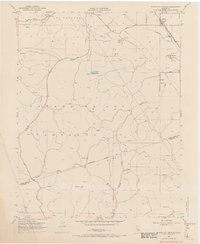
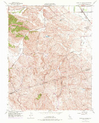
1953 Map of Byron Hot Springs
USGS Topo · Published 1969About this map
Byron Hot Springs sits at the intersection of early California ranching and the developing industrial infrastructure of the mid-20th century. The settlement of Byron serves as a hub near the Southern Pacific railroad line, while the surrounding landscape of Los Meganos and Cañada de los Vaqueros is defined by a complex network of water and energy transport. Significant features like the Irrigation Canal and various reservoirs highlight the managed water systems essential to this arid region.
Find a feature on this map
35 named features on this map. Tap any name to fly to it.
Don’t see what you’re looking for? This feature index may not catch every label — zoom into the map to look around manually.
Map Details
Editions of this 1953 Byron Hot Springs Map
5 editions found
Other maps of this area

1896 · Mt. Diablo
USGS Topo · 1:62,500

1898 · Mt. Diablo
USGS Topo · 1:62,500

1906 · Pleasanton
USGS Topo · 1:62,500

1907 · Tesla
USGS Topo · 1:62,500

1911 · Byron Hot Springs
USGS Topo · 1:31,680

1913 · Woodward Island
USGS Topo · 1:31,680

1914 · Brentwood
USGS Topo · 1:31,680

1914 · Bethany
USGS Topo · 1:31,680

1916 · Lone Tree Valley
USGS Topo · 1:31,680

1916 · Byron Hot Springs
USGS Topo · 1:31,680