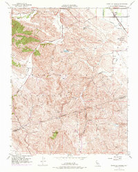
1953 Map of Byron Hot Springs
USGS Topo · Published 1975About this map
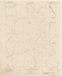
Byron Hot Springs sits at the base of rising terrain in eastern Contra Costa County, anchoring a landscape where agricultural flats meet the prominent ridges of Canada De Los Vaqueros. During the mid-twentieth century, the area served as a crossroads for transit and utility infrastructure, with the Southern Pacific railroad line and a major Pipe Line corridor cutting through the northern reaches near the town of Byron. The map documents a rugged interior of canyons and peaks, including the high point at Brushy Peak, which straddles the Contra Costa Co Alameda Co line. Water management is a central theme, evidenced by the Canal system, various Springs, and the drainage of Kellogg Creek. Significant industrial markers like an Oil Pumping Station and scattered prospects suggest the region's historical ties to petroleum and mineral extraction amidst the cattle-grazing land of Los Meganos.
Find a feature on this map
27 named features on this map. Tap any name to fly to it.
Don’t see what you’re looking for? This feature index may not catch every label — zoom into the map to look around manually.
Map Details
Editions of this 1953 Byron Hot Springs Map
5 editions found
Other maps of this area

1896 · Mt. Diablo
USGS Topo · 1:62,500

1898 · Mt. Diablo
USGS Topo · 1:62,500

1906 · Pleasanton
USGS Topo · 1:62,500

1907 · Tesla
USGS Topo · 1:62,500

1911 · Byron Hot Springs
USGS Topo · 1:31,680

1913 · Woodward Island
USGS Topo · 1:31,680

1914 · Brentwood
USGS Topo · 1:31,680

1914 · Bethany
USGS Topo · 1:31,680

1916 · Lone Tree Valley
USGS Topo · 1:31,680

1916 · Byron Hot Springs
USGS Topo · 1:31,680