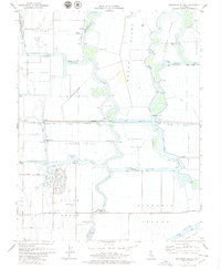
1978 Map of Woodward Island
USGS Topo · Published 1979About this map
Bacon Island and the surrounding Sacramento-San Joaquin Delta landscape are defined by an intricate network of man-made waterways and reclaimed tracts in this late 1970s survey. The map details the complex hydraulic engineering of the region, where the Mokelumne Aqueduct and numerous siphons intersect with natural channels like the Old River and Middle River. Settlements such as Orwood and Bixler sit along the Atchison Topeka and Santa Fe railroad, illustrating the vital transport links that served these agricultural islands.
Find a feature on this map
50 named features on this map. Tap any name to fly to it.
Don’t see what you’re looking for? This feature index may not catch every label — zoom into the map to look around manually.
Map Details
Editions of this 1978 Woodward Island Map
2 editions found
Other maps of this area

1894 · Lodi
USGS Topo · 1:125,000

1910 · Bouldin
USGS Topo · 1:31,680

1910 · Jersey
USGS Topo · 1:31,680

1910 · Headreach
USGS Topo · 1:31,680

1911 · Byron Hot Springs
USGS Topo · 1:31,680

1913 · Woodward Island
USGS Topo · 1:31,680

1913 · Holt
USGS Topo · 1:31,680

1914 · Brentwood
USGS Topo · 1:31,680

1914 · Bethany
USGS Topo · 1:31,680

1914 · Union Island
USGS Topo · 1:31,680