
1895 Map of Byron
USGS Topo · Published 1895About this map
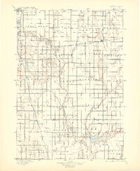
The James River carves a winding path through this portion of eastern South Dakota, defining a landscape organized into an orderly grid of townships in the late nineteenth century. The Chicago and Northwestern R. R. serves as the primary artery for regional commerce, connecting grain-handling points like Doland and Frankfort. This 1893 survey captures the early development of Spink Co. and Beadle Co. before modern irrigation transformed the prairie, showing the natural hydrology of Turtle Creek and Foster Creek feeding into the river. Near the southern border, the waters of Byron Lake and Connor Lake sit adjacent to the small settlement at Lakeside, providing a rare aquatic focus in an otherwise agricultural landscape. The map preserves the locations of early post offices and rail stops such as Winthrop, Crandon, and Hitchcock, which were essential nodes for pioneer families settling the Dakota Territory.
Find a feature on this map
50 named features on this map. Tap any name to fly to it.
Don’t see what you’re looking for? This feature index may not catch every label — zoom into the map to look around manually.
Map Details
Editions of this 1895 Byron Map
4 editions found
Other maps of this area

1894 · Conde
USGS Topo · 1:62,500

1895 · Aberdeen
USGS Topo · 1:125,000

1898 · Huron
USGS Topo · 1:125,000

1899 · Northville
USGS Topo · 1:125,000

1899 · Redfield
USGS Topo · 1:125,000

1899 · De Smet
USGS Topo · 1:125,000

1950 · Wessington NE
USGS Topo · 1:24,000

1953 · Frankfort
USGS Topo · 1:24,000

1953 · Redfield North
USGS Topo · 1:24,000

1953 · Gallup
USGS Topo · 1:24,000