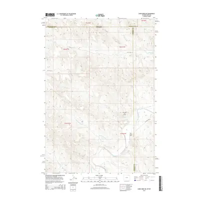
2015 Map of Cabin Creek NE
USGS Topo · Published 2015About this map
Powder River drainage dominates this high-plains landscape at the border of Wyoming and Montana, where Campbell, Sheridan, and Powder River counties converge. The terrain is defined by a dense network of seasonal watercourses and draws that feed the larger river system, including Big Remington Creek, Little Remington Creek, and Fence Creek. A notable topographical landmark, Hells Half Acre Canyon, sits tucked between the ridges near Gray Cabin Draw. This 2015 survey reveals a remote ranching landscape where infrastructure is limited to primitive routes like Fence Creek Road and Big Powder River Road. The presence of Ford Reservoir Number 1 and scattered creek beds like Red Prong and Clear Creek illustrate the critical importance of water management in this arid environment.
Find a feature on this map
22 named features on this map. Tap any name to fly to it.
Don’t see what you’re looking for? This feature index may not catch every label — zoom into the map to look around manually.
Map Details
Editions of this 2015 Cabin Creek NE Map
This is the sole edition of this map. No revisions or reprints were ever made.
Other maps of this area

1954 · Hardin
USGS Topo · 1:250,000

1954 · Ekalaka
USGS Topo · 1:250,000

1954 · Gillette
USGS Topo · 1:250,000

1955 · Sheridan
USGS Topo · 1:250,000

1955 · Gillette
USGS Topo · 1:250,000

1956 · Ekalaka
USGS Topo · 1:250,000

1957 · Hardin
USGS Topo · 1:250,000

1958 · Gillette
USGS Topo · 1:250,000

1958 · Ekalaka
USGS Topo · 1:250,000

1958 · Hardin
USGS Topo · 1:250,000