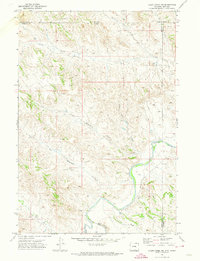
1971 Map of Cabin Creek NE
USGS Topo · Published 1974About this map
The Powder River carves a significant course through this borderland region where Montana and Wyoming meet, creating a landscape defined by deep drainages and industrial expansion. During the early 1970s, the energy economy is clearly visible through the development of the Fence Creek Oil Field and numerous drill holes scattered across the high ground between Fence Creek and Little Remington Creek. This era of exploration is balanced by the persistence of traditional landmarks, including the rugged Hells Half Acre Canyon and the winding paths of Big Remington Creek. Geopolitically, the map provides a precise look at the intersecting boundaries of Powder River, Sheridan, and Campbell counties, illustrating how these administrative lines follow the high ridges above Cabin Creek and Clear Creek.
Find a feature on this map
16 named features on this map. Tap any name to fly to it.
Don’t see what you’re looking for? This feature index may not catch every label — zoom into the map to look around manually.
Map Details
Editions of this 1971 Cabin Creek NE Map
This is the sole edition of this map. No revisions or reprints were ever made.
Other maps of this area

1954 · Hardin
USGS Topo · 1:250,000

1954 · Ekalaka
USGS Topo · 1:250,000

1954 · Gillette
USGS Topo · 1:250,000

1955 · Sheridan
USGS Topo · 1:250,000

1955 · Gillette
USGS Topo · 1:250,000

1956 · Ekalaka
USGS Topo · 1:250,000

1957 · Hardin
USGS Topo · 1:250,000

1958 · Gillette
USGS Topo · 1:250,000

1958 · Ekalaka
USGS Topo · 1:250,000

1958 · Hardin
USGS Topo · 1:250,000