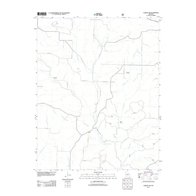
2012 Map of Cabool SW
USGS Topo · Published 2012About this map
The North Fork River winds through this section of Texas County, defining a landscape of deep hollows and timbered ridges just south of Cabool. The small settlement of Ann serves as a central landmark for this rural area, where family history is anchored by the Macedonia Cemetery and the Little Creek School. The drainage patterns are intricate, with Panther Creek, Hungry Creek, and White Creek carving through the Ozark plateau. To the east, the terrain drops into Big Gulch, while several small tributaries like Parker Branch and Red Bank Creek feed the larger river system. This 2012 survey documents a network of county roads including Dogwood Rd and Pointer Rd that follow the natural topography, connecting scattered homesteads to the river valley and the northern hills of the county.
Find a feature on this map
36 named features on this map. Tap any name to fly to it.
Don’t see what you’re looking for? This feature index may not catch every label — zoom into the map to look around manually.
Map Details
Editions of this 2012 Cabool SW Map
This is the sole edition of this map. No revisions or reprints were ever made.
Other maps of this area

1937 · Buckhart
USGS Topo · 1:48,000

1939 · Topaz
USGS Topo · 1:62,500

1941 · Topaz
USGS Topo · 1:62,500

1943 · Buckhart
USGS Topo · 1:62,500

1945 · Harrison
USGS Topo · 1:250,000

1945 · Buckhart
USGS Topo · 1:62,500

1949 · Harrison
USGS Topo · 1:250,000

1950 · Cabool SW
USGS Topo · 1:24,000

1951 · Mountain Grove South
USGS Topo · 1:24,000

1951 · Cabool SE
USGS Topo · 1:24,000