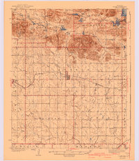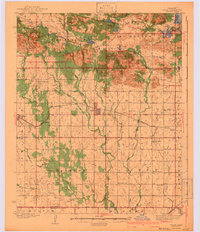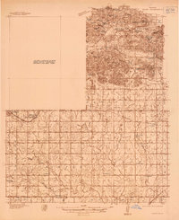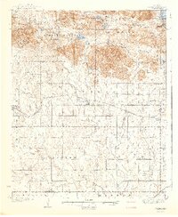
1942 Map of Cache
USGS Topo · Published 1942About this map
The Wichita Mountains Wildlife Refuge dominates the northern half of this landscape, where granite peaks like Mt Scott and Mt McKinley overlook a network of man-made lakes including Quanah Parker Lake and Lake Jed Johnson. To the east, the rugged terrain of the McMaster Mountains gives way to the high-security boundary of the Fort Sill Military Reservation. This 1930s-era survey captures a rural Oklahoma community defined by its dispersed churches and schools, such as Devo Memorial Chapel and Spring Valley Sch, which served farming families between the mountains and the Base Line.
Find a feature on this map
72 named features on this map. Tap any name to fly to it.
Don’t see what you’re looking for? This feature index may not catch every label — zoom into the map to look around manually.
Map Details
Editions of this 1942 Cache Map
3 editions found