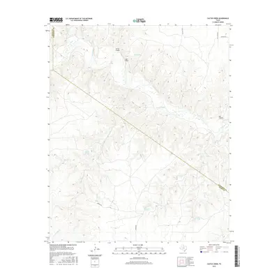
2016 Map of Cactus Creek
USGS Topo · Published 2016About this map
The Pease River cuts through the northern reaches of this landscape, defining a terrain of named breaks and canyons such as Red Bluff and Spring Canyon. This territory, where Hardeman, Cottle, and Foard counties meet, is characterized by a sparse network of ranch roads and remote water sources. Local hydrology is marked by the presence of Dripping Springs and Talking John Springs, which likely served as vital landmarks for early travelers and cattlemen in this arid region of the Texas Panhandle. The map reveals how local drainage systems like Talking John Cr and Cactus Cr feed into the river basin. Man-made improvements for livestock are evident through features like Canyon Tank and Willow Tank, while named routes such as Mormon Rd and Lazy U Ranch Rd suggest the historic and contemporary ranching operations that have long shaped this area.
Find a feature on this map
18 named features on this map. Tap any name to fly to it.
Don’t see what you’re looking for? This feature index may not catch every label — zoom into the map to look around manually.
Map Details
Editions of this 2016 Cactus Creek Map
This is the sole edition of this map. No revisions or reprints were ever made.
Other maps of this area

1927 · Quanah 3-a
USGS Topo · 1:48,000

1927 · Quanah 3-b
USGS Topo · 1:48,000

1932 · Vivian
USGS Topo · 1:62,500

1954 · Plainview
USGS Topo · 1:250,000

1955 · Lawton
USGS Topo · 1:250,000

1958 · Plainview
USGS Topo · 1:250,000

1960 · Goodlett
USGS Topo · 1:62,500

1960 · Teacup Mountain
USGS Topo · 1:62,500

1967 · Kirkland South
USGS Topo · 1:24,000

1967 · Triangle Ranch
USGS Topo · 1:24,000