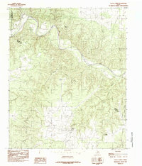
1984 Map of Cactus Creek
USGS Topo · Published 1985About this map
The Pease River carves a winding path through this corner of the Texas Rolling Plains, defining the jurisdictional boundary where Cottle and Hardeman counties meet. The landscape is dominated by a complex network of seasonal drainages and erosion-cut features, including the prominent Red Bluff and the deep incisions of Bull Canyon. Settlement is sparse in this era, with the map primarily documenting water sources critical to ranching and land use in a semi-arid environment.
Find a feature on this map
13 named features on this map. Tap any name to fly to it.
Don’t see what you’re looking for? This feature index may not catch every label — zoom into the map to look around manually.
Map Details
Editions of this 1984 Cactus Creek Map
This is the sole edition of this map. No revisions or reprints were ever made.
Other maps of this area

1927 · Quanah 3-a
USGS Topo · 1:48,000

1927 · Quanah 3-b
USGS Topo · 1:48,000

1932 · Vivian
USGS Topo · 1:62,500

1954 · Plainview
USGS Topo · 1:250,000

1955 · Lawton
USGS Topo · 1:250,000

1958 · Plainview
USGS Topo · 1:250,000

1960 · Goodlett
USGS Topo · 1:62,500

1960 · Teacup Mountain
USGS Topo · 1:62,500

1967 · Kirkland South
USGS Topo · 1:24,000

1967 · Triangle Ranch
USGS Topo · 1:24,000