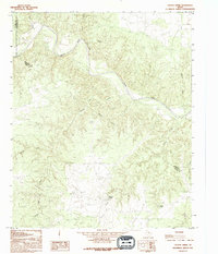
1990 Map of Cactus Creek
USGS Topo · Published 1995About this map
The Pease River cuts a prominent path across this landscape at the intersection of Foard, Hardeman, and Cottle Counties. This 1990 provisional survey documents a terrain defined by complex drainages and naming conventions that reflect the local geography. Significant water sources like Dripping Springs and Willow Tank are critical markers in this arid region, providing essential water for livestock and early inhabitants.
Find a feature on this map
15 named features on this map. Tap any name to fly to it.
Don’t see what you’re looking for? This feature index may not catch every label — zoom into the map to look around manually.
Map Details
Editions of this 1990 Cactus Creek Map
This is the sole edition of this map. No revisions or reprints were ever made.
Other maps of this area

1927 · Quanah 3-a
USGS Topo · 1:48,000

1927 · Quanah 3-b
USGS Topo · 1:48,000

1932 · Vivian
USGS Topo · 1:62,500

1954 · Plainview
USGS Topo · 1:250,000

1955 · Lawton
USGS Topo · 1:250,000

1958 · Plainview
USGS Topo · 1:250,000

1960 · Goodlett
USGS Topo · 1:62,500

1960 · Teacup Mountain
USGS Topo · 1:62,500

1967 · Kirkland South
USGS Topo · 1:24,000

1967 · Triangle Ranch
USGS Topo · 1:24,000