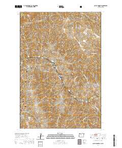
2020 Map of Cactus Mountain
USGS Topo · Published 2020About this map
Dug Bar sits at the heart of this canyon landscape where the Snake River carves a deep boundary between Idaho and Oregon. This 2020 survey documents the river’s path through the Snake Wild and Scenic River corridor, including treacherous points like Warm Springs Rapids and Dug Creek Rapids. The terrain is defined by steep elevation changes from the water's edge up to peaks such as Cactus Mtn and Sugarloaf Butte. Transport in this difficult environment is limited to the Dug Bar Airport and a network of pathways including the Nez Perce National Historic Trail and the Western Rim-Natl Recreation Trail. Numerous gulches and canyons, such as Canaan Canyon and Robinson Gulch, drain toward the river, illustrating the complex hydrology of the Wallowa National Forest.
Find a feature on this map
66 named features on this map. Tap any name to fly to it.
Don’t see what you’re looking for? This feature index may not catch every label — zoom into the map to look around manually.
Map Details
Editions of this 2020 Cactus Mountain Map
This is the sole edition of this map. No revisions or reprints were ever made.
Other maps of this area

1954 · Imnaha
USGS Topo · 1:62,500

1954 · Kernan Point
USGS Topo · 1:62,500

1955 · Grangeville
USGS Topo · 1:250,000

1959 · Grangeville
USGS Topo · 1:250,000

1963 · Cactus Mtn
USGS Topo · 1:24,000

1963 · Deadhorse Ridge
USGS Topo · 1:24,000

1963 · Boles
USGS Topo · 1:24,000

1963 · Rattlesnake Ridge
USGS Topo · 1:24,000

1963 · Wapshilla Creek
USGS Topo · 1:24,000

1963 · Wolf Creek
USGS Topo · 1:24,000