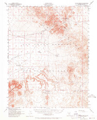
1952 Map of Cactus Spring
USGS Topo · Published 1964About this map
The Cactus Range dominates this mid-century topographic study, which captures a desert landscape defined by both its mining history and its evolving military utility. Near the northern peaks, Cactus Spring and the Urania Mine mark sites of early 20th-century industry, while to the south, the Gold Crater (Site) and various Mining Areas indicate the region's extraction-based origins.
Find a feature on this map
17 named features on this map. Tap any name to fly to it.
Don’t see what you’re looking for? This feature index may not catch every label — zoom into the map to look around manually.
Map Details
Editions of this 1952 Cactus Spring Map
3 editions found
Other maps of this area

1908 · Kawich
USGS Topo · 1:250,000

1908 · Lida
USGS Topo · 1:250,000

1913 · Lida
USGS Topo · 1:250,000

1942 · Tolicha Peak
USGS Topo · 1:125,000

1942 · Cactus Range
USGS Topo · 1:125,000

1945 · Goldfield
USGS Topo · 1:125,000

1952 · Stinking Spring
USGS Topo · 1:62,500

1952 · Mellan
USGS Topo · 1:62,500

1952 · Cactus Spring
USGS Topo · 1:62,500

1952 · Mud Lake
USGS Topo · 1:62,500