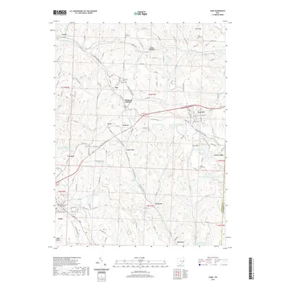
2019 Map of Cadiz
USGS Topo · Published 2019About this map
Cadiz serves as the seat of government, anchored by the Harrison County Courthouse and several historic burial grounds including Old Cadiz Cem and Union Cem. This portion of Harrison County is defined by a landscape of high ridges like Blue Ridge and Piney Ridge, interspersed with numerous water management and industrial sites. The industrial footprint of the region is evident through features such as the Consolidation Coal Company Pond 0207, Jeffco Pond, and the Wheeling And Lake Erie railroad line which threads through the hills via the Rexford Tunnel. Smaller communities like Hopedale, Jewett, and Unionvale are connected by a dense network of township and county roads, reflecting a pattern of upland settlement and resource extraction. Significant water features like Sparrow Reservoir and Pine Valley Sportsmens Lake Number 6 dot the drainages of Conotton Cr and N Fork Short Cr.
Find a feature on this map
133 named features on this map. Tap any name to fly to it.
Don’t see what you’re looking for? This feature index may not catch every label — zoom into the map to look around manually.
Map Details
Editions of this 2019 Cadiz Map
This is the sole edition of this map. No revisions or reprints were ever made.
Other maps of this area

1901 · Cadiz
USGS Topo · 1:62,500

1902 · Scio
USGS Topo · 1:62,500

1903 · Cadiz
USGS Topo · 1:62,500

1903 · Flushing
USGS Topo · 1:62,500

1904 · Scio
USGS Topo · 1:62,500

1905 · St. Clairsville
USGS Topo · 1:62,500

1905 · Flushing
USGS Topo · 1:62,500

1951 · Canton
USGS Topo · 1:250,000

1953 · Canton
USGS Topo · 1:250,000

1957 · Canton
USGS Topo · 1:250,000