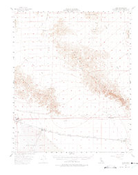
1956 Map of Cadiz
USGS Topo · Published 1975About this map
The arid landscape of the Mojave Desert centers on the white expanse of Bristol Lake and its industrial Salt Evaporators in the mid-1950s. This terminal basin is flanked by the volcanic Lava flows to the west and the complex topography of the Bristol Mts and Marble Mountains. Settlement is clustered along the Atchison Topeka and Santa Fe railroad corridor, where small desert outposts like Amboy, Saltus, and Cadiz served as vital transit and resource points. The map documents an era of resource extraction and infrastructure, evidenced by the Castle Mine and Iron Hat Mine tucked into the mountain ranges, alongside a network of Pipelines and a lonely Jeep Trail cutting across the desert floor.
Find a feature on this map
35 named features on this map. Tap any name to fly to it.
Don’t see what you’re looking for? This feature index may not catch every label — zoom into the map to look around manually.
Map Details
Editions of this 1956 Cadiz Map
3 editions found

Other maps of this area

1942 · Amboy
USGS Topo · 1:250,000

1943 · Amboy
USGS Topo · 1:250,000

1943 · Danby
USGS Topo · 1:62,500

1943 · Cadiz Lake
USGS Topo · 1:62,500

1954 · Needles
USGS Topo · 1:250,000

1954 · Bristol Lake NW
USGS Topo · 1:24,000

1954 · Amboy Crater
USGS Topo · 1:24,000

1955 · Lead Mtn. NE
USGS Topo · 1:24,000

1955 · Lead Mountain
USGS Topo · 1:62,500

1956 · Needles
USGS Topo · 1:250,000