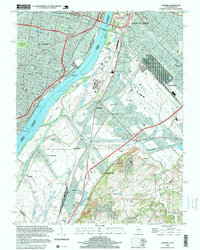
1998 Map of Cahokia
USGS Topo · Published 1999About this map
The Mississippi River serves as the focal point for this late-century look at the industrial and urban corridor connecting Missouri and Illinois. On the western bank, the urban grid of St Louis is marked by community landmarks such as Tower Grove Park and the Good Shepherd Convent, while the eastern side reveals a landscape defined by drainage and heavy industry. The area around Cahokia and Sauget is dense with infrastructure, including numerous gas tanks and the Parks College Airport.
Find a feature on this map
55 named features on this map. Tap any name to fly to it.
Don’t see what you’re looking for? This feature index may not catch every label — zoom into the map to look around manually.
Map Details
Editions of this 1998 Cahokia Map
This is the sole edition of this map. No revisions or reprints were ever made.
Other maps of this area

1888 · St. Louis
USGS Topo · 1:62,500

1910 · Waterloo
USGS Topo · 1:62,500

1912 · Kimmswick
USGS Topo · 1:62,500

1913 · Waterloo
USGS Topo · 1:62,500

1916 · Kimmswick
USGS Topo · 1:62,500

1931 · French Village
USGS Topo · 1:24,000

1933 · Granite City
USGS Topo · 1:24,000

1933 · Jefferson Barracks
USGS Topo · 1:24,000

1933 · Cahokia
USGS Topo · 1:24,000

1933 · Clayton
USGS Topo · 1:24,000