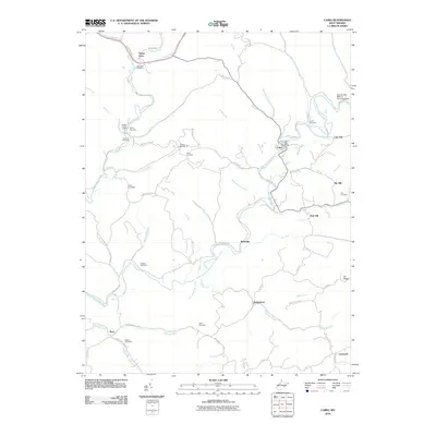
2010 Map of Cairo
USGS Topo · Published 2010About this map
The North Fork Hughes River meanders through this Ritchie County landscape, anchoring the settlement of Cairo and its Cairo Post Office. This 2010 topographic record highlights a region defined by narrow valleys and named ridges such as Oil Ridge and Pew Hill. The distribution of family-named burial grounds, including the Rexroad Cemetery, Elfritz Cemetery, and Mason Cemetery, offers a clear spatial genealogy of the area's rural communities. An interesting industrial footprint remains visible in the form of Tunnel Number 19 and the site labeled Number One West of Cornwallis Dam near the river's northern bend. Smaller hamlets like Riverside, Rutherford, and Nutter Farm are connected by a network of winding county roads like Cairo Cisco Rd and Old US Hwy 50, tracing the natural drainage of creeks such as Devilhole Creek and Goose Creek.
Find a feature on this map
74 named features on this map. Tap any name to fly to it.
Don’t see what you’re looking for? This feature index may not catch every label — zoom into the map to look around manually.
Map Details
Editions of this 2010 Cairo Map
This is the sole edition of this map. No revisions or reprints were ever made.
Other maps of this area

1904 · Marietta
USGS Topo · 1:62,500

1906 · Saint Marys
USGS Topo · 1:62,500

1906 · Elizabeth
USGS Topo · 1:62,500

1907 · Harrisville
USGS Topo · 1:62,500

1924 · St Marys
USGS Topo · 1:62,500

1924 · Harrisville
USGS Topo · 1:62,500

1924 · Marietta
USGS Topo · 1:62,500

1924 · Elizabeth
USGS Topo · 1:62,500

1926 · Elizabeth
USGS Topo · 1:62,500

1926 · Harrisville
USGS Topo · 1:62,500