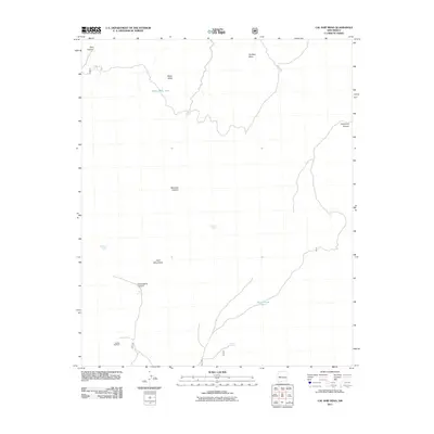
2011 Map of Cal Ship Mesa
USGS Topo · Published 2011About this map
The Datil Mountains define the high-elevation landscape of this southwestern New Mexico region, where the terrain is marked by expansive mesas and deep canyon systems. Water management is the primary human imprint on this arid environment, evidenced by scattered improvements such as White Mesa Tank, Government Tank, and the Sawmill Windmill. These features, alongside named water sources like Skeleton Spring and Maverick Spring, suggest a history of ranching and livestock movement through the rugged draws of Pine Canyon and Thompson Canyon. The presence of Forest Rd 507 provides limited access into these uplands, which transition from the broad top of Cal Ship Mesa into the steep descent of Gooseberry Canyon.
Find a feature on this map
15 named features on this map. Tap any name to fly to it.
Don’t see what you’re looking for? This feature index may not catch every label — zoom into the map to look around manually.
Map Details
Editions of this 2011 Cal Ship Mesa Map
This is the sole edition of this map. No revisions or reprints were ever made.
Other maps of this area

1954 · Socorro
USGS Topo · 1:250,000

1958 · Socorro
USGS Topo · 1:250,000

1962 · Socorro
USGS Topo · 1:250,000

1963 · Cal Ship Mesa
USGS Topo · 1:24,000

1963 · Datil
USGS Topo · 1:24,000

1964 · Third Canyon
USGS Topo · 1:24,000

1964 · Dog Springs
USGS Topo · 1:24,000

1964 · Pasture Canyon
USGS Topo · 1:24,000
1964 · Madre Mountain
USGS Topo · 1:24,000

1964 · Crosby Springs
USGS Topo · 1:24,000